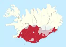
Suðurland
Le Suðurland, littéralement « terre du Sud », est l'une des huit régions de l'Islande. Son chef-lieu est Selfoss.
| Suðurland | |
| |
| Administration | |
|---|---|
| Pays | |
| Type | Région |
| Siège | Selfoss |
| ISO 3166-2 | 8 |
| Démographie | |
| Population | 29 987 hab. (2022) |
| Densité | 1,2 hab./km2 |
| Géographie | |
| Superficie | 24 526 km2 |
Démographie
| Année | Population | Pourcentage de la population islandaise |
|---|---|---|
| 1920 | 13 785 | 14,60 % |
| 1930 | 13 694 | 12,61 % |
| 1940 | 13 555 | 11,15 % |
| 1950 | 13 826 | 9,58 % |
| 1960 | 16 018 | 8,94 % |
| 1970 | 18 052 | 8,82 % |
| 1980 | 19 637 | 8,49 % |
| 1990 | 20 402 | 7,92 % |
| 2000 | 21 119 | 7,41 % |
| 2007 | 23 478 | 7,46 % |
| 2020 | 28 399 | 7,80 % |
| 2022 | 29 987 | 7,96 % |
Municipalités du Suðurland
- Population en 2022:
- Árborg (10 834 habitants)
- Ásahreppur (261 habitants),
- Bláskógabyggð (1 164 habitants),
- Flóahreppur (694 habitants),
- Grímsnes- og Grafningshreppur (525 habitants),
- Hrunamannahreppur (818 habitants),
- Hveragerði (2 984 habitants),
- Mýrdalshreppur (814 habitants),
- Rangárþing eystra (1 971 habitants),
- Rangárþing ytra (1 810 habitants),
- Skaftárhreppur (641 habitants),
- Skeiða- og Gnúpverjahreppur (576 habitants),
- Ölfus (2 481 habitants),
- Vestmannaeyjar (4 414 habitants)
Comtés du Suðurland
Galerie
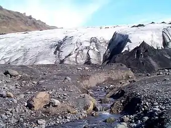 Le glacier Mýrdalsjökull.
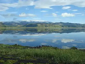 Le volcan Katla recouvert par le Mýrdalsjökull.
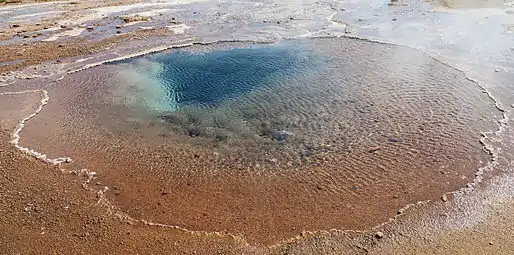 Le bassin de Blesi, à côté du Geysir.
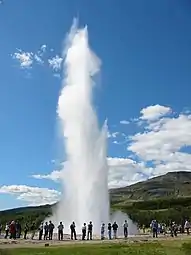 Le Strokkur.
 Portail de l’Islande
Cet article est issu de Wikipedia. Le texte est sous licence Creative Commons – Attribution – Partage à l’identique. Des conditions supplémentaires peuvent s’appliquer aux fichiers multimédias.