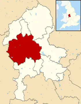
Stafford (district)
Stafford est un district non métropolitain du Staffordshire, en Angleterre. Sa population est de 130 869 habitants (2011)[1].
| Stafford | |
| |
| Administration | |
|---|---|
| Pays | |
| Statut | District non métropolitain |
| Région | Midlands de l'Ouest |
| Comté | Staffordshire |
| Démographie | |
| Population | 130 869 hab. (2011) |
| Géographie | |
| Coordonnées | 52° 48′ 18″ nord, 2° 07′ 00″ ouest |
| Liens | |
| Site web | http://www.staffordbc.gov.uk/ |
Composition
Le district est composé des paroisses civiles suivantes[2]:
- Adbaston
- Barlaston
- Berkswich
- Bradley
- Brocton
- Chebsey
- Church Eaton
- Colwich
- Creswell
- Doxey
- Eccleshall
- Ellenhall
- Forton
- Fradswell
- Fulford
- Gayton
- Gnosall
- Haughton
- High Offley
- Hilderstone
- Hixon
- Hopton and Coton
- Hyde Lea
- Ingestre
- Marston
- Milwich
- Norbury
- Ranton
- Salt and Enson
- Sandon and Burston
- Seighford
- Standon
- Stone
- Stone Rural
- Stowe-by-Chartley
- Swynnerton
- Tixall
- Weston
- Whitgreave
Notes et références
- (en) « Area: Stafford (Local Authority) », Office for national statistics (consulté le )
- (en) « Stafford », Ordnance Survey (consulté le )
Cet article est issu de Wikipedia. Le texte est sous licence Creative Commons – Attribution – Partage à l’identique. Des conditions supplémentaires peuvent s’appliquer aux fichiers multimédias.