Route nationale 49 (Inde)
La Route nationale 49 (en anglais : National Highway 49, sigle NH 49), une route nationale en Inde qui s'étend de Bilaspur au Chhattisgarh jusqu'à Kharagpur au Bengale-Occidental.
| Route nationale 49 | |

| |
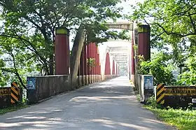 Pont de Neriyamangalam. | |
| Caractéristiques | |
|---|---|
| Longueur | 668 km |
| De | Bilaspur |
| Intersections | |
| À | Kharagpur |
| Réseau | |
| Territoires traversés | |
| Région | Chhattisgarh, Odisha, Jharkhand, Bengale-Occidental |
| Villes principales | Bilaspur, Raigarh, Jharsuguda, Kendujhargarh, Kharagpur |
Tracé
Partant de la NH 130 près de Bilaspur au Chhattisgarh elle se termine en rencontrant la NH 16 près de Kharagpur, au Bengale occidental. La route fait partie du réseau AH46. La route nationale mesure 668 km de long[1],[2].
La NH49 traverse les États du Chhattisgarh, de l'Odisha, du Jharkhand et du Bengale-Occidentalen passant par les villes suivantes[3]:
- Chhattisgarh
Bilaspur, Saragaon, Sakti, Raigarh
- Odisha
Kanaktora, Jharsuguda, Kuchinda, Pravasuni, Deogarh, Barakot, Pal Laharha, Kendujhargarh, Turumunga, Chadheibhol, Jashipur, Bangriposhi
- Jharkhand
Baharagora
- Bengale-Occidental
Références
- « State-wise length of National Highways in India as on 30.06.2017 » [archive du ], sur National Highways Authority of India (consulté le )
- « New Numbering of National Highways notification - Government of India », sur The Gazette of India (consulté le )
- « State-wise length of National Highways (NH) in India as on 30.11.2018 » [archive du ], sur Ministry of Road Transport and Highways (consulté le )
Voir aussi
Liens externes
 Portail de la route
  Portail de l’Inde
Cet article est issu de Wikipedia. Le texte est sous licence Creative Commons – Attribution – Partage à l’identique. Des conditions supplémentaires peuvent s’appliquer aux fichiers multimédias.