Lhota pod Hořičkami
Lhota pod Hořičkami (en allemand : Lhota unter Klein Horschitz) est une commune du district de Náchod, dans la région de Hradec Králové, en Tchéquie. Sa population s'élevait à 304 habitants en 2020[1].
| Lhota pod Hořičkami | |
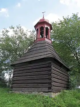 Lhota pod Hořičkami : beffroi. | |
 |
 |
| Administration | |
|---|---|
| Pays | |
| Région | |
| District | Náchod |
| Région historique | Bohême |
| Maire | Darina Kricnarová |
| Code postal | 552 05 |
| Indicatif téléphonique international | +(420) |
| Démographie | |
| Population | 304 hab. (2020) |
| Densité | 51 hab./km2 |
| Géographie | |
| Coordonnées | 50° 25′ 22″ nord, 16° 00′ 11″ est |
| Altitude | 319 m |
| Superficie | 591 ha = 5,91 km2 |
| Localisation | |
| Liens | |
| Site web | www.lhotapodhorickami.cz |
Géographie
Lhota pod Hořičkami se trouve à 5 km au nord-ouest de Česká Skalice, à 12 km à l'ouest de Náchod, à 27 km au nord-est de Hradec Králové et à 118 km à l'est-nord-est de Prague[2].
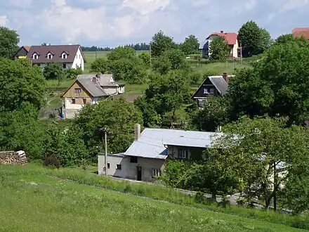 Hameau de Světlou pod Hořičkami.
La commune est limitée par Hořičky au nord, par Vestec à l'est, par Chvalkovice au sud et au sud-ouest, et par Brzice au nord-ouest[3].
Histoire
La première mention écrite de la localité date de 1405.
Administration
La commune se compose de trois quartiers :
- Lhota pod Hořičkami
- Světlá
- Újezdec
Notes et références
- (cs) Population des communes de la République tchèque au 1er janvier 2020.
- Distances à vol d'oiseau ou distances orthodromiques.
- D'après geoportal.gov.cz.
 Portail de la Tchéquie
Cet article est issu de Wikipedia. Le texte est sous licence Creative Commons – Attribution – Partage à l’identique. Des conditions supplémentaires peuvent s’appliquer aux fichiers multimédias.