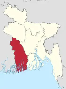
Khulna (division)
La division de Khulnâ est une des huit divisions administratives du Bangladesh.

Vue du Bangladesh prise lors de l'expédition ISS 12
| District | Upazila | Union | Village | Municipalité | Population |
|---|---|---|---|---|---|
| Bagerhat | 9 | 75 | 1 031 | 3 | 1 549 031 |
| Chuadanga | 4 | 31 | 514 | 4 | 1 007 130 |
| Jessore | 8 | 92 | 1 434 | 4 | 2 471 554 |
| Jhenaidah | 6 | 67 | 1 152 | 5 | 1 579 490 |
| Khulna | 14 | 70 | 1 119 | 2 | 2 378 971 |
| Kushtia | 6 | 61 | 978 | 4 | 1 740 155 |
| Magura | 4 | 36 | 700 | 1 | 824 311 |
| Meherpur | 3 | 18 | 277 | 1 | 591 436 |
| Narail | 3 | 37 | 651 | 2 | 698 447 |
| Satkhira | 7 | 78 | 1 435 | 2 | 1 864 704 |
| 10 | 64 | 565 | 9 284 | 28 | 14 705 229 |
| Khulna | |
| |
| Administration | |
|---|---|
| Pays | |
| Capitale | Khulna |
| Démographie | |
| Population | 15 563 000 hab. (2011) |
| Densité | 698 hab./km2 |
| Géographie | |
| Coordonnées | 22° 55′ nord, 89° 15′ est |
| Superficie | 2 228 541 ha = 22 285,41 km2 |
Notes et références
Cet article est issu de Wikipedia. Le texte est sous licence Creative Commons – Attribution – Partage à l’identique. Des conditions supplémentaires peuvent s’appliquer aux fichiers multimédias.