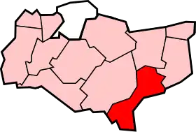
Folkestone and Hythe (district)
Folkestone and Hythe est un district d'Angleterre dans le sud-ouest du Kent, au bord de la Manche.
| District de Folkestone and Hythe | |
| |
| Administration | |
|---|---|
| Pays | |
| Statut | District |
| Région | Angleterre du Sud-Est |
| Comté | Kent |
| Centre administratif | Folkestone |
| Leadership | Leader & Cabinet |
| Exécutif | Conservateur |
| MP | Damian Collins |
| Code ONS | 29UL |
| Démographie | |
| Population | 101 200 hab. (2010) |
| Densité | 284 hab./km2 |
| Rang | 222e / 326 |
| Ethnicité | 97,3 % Blanc 1,5 % Asiatique |
| Géographie | |
| Coordonnées | 51° 04′ 43,86″ nord, 1° 10′ 28,61″ est |
| Superficie | 35 670 ha = 356,70 km2 |
| Rang | 118e / 326 |
| Liens | |
| Site web | http://www.shepway.gov.uk/ |
De sa fondation le 1er avril 1974 jusqu'à 2018, il s'appelle Shepway ; cette année-là, le conseil change son nom afin de mieux décrire sa localisation.
Liste des paroisses de Folkestone and Hythe
- Acrise
- Brenzett
- Brookland
- Burmarsh
- Dymchurch
- Elham
- Elmsted
- Folkestone (ville)
- Hawkinge
- Hythe (ville)
- Ivychurch
- Lydd (ville)
- Lyminge
- Lympne
- Monks Horton
- Newchurch
- Newington
- New Romney (town)
- Old Romney
- Paddlesworth
- Postling
- Saltwood
- Sandgate
- Sellindge
- Snargate
- St Mary in the Marsh
- Stanford
- Stelling Minnis
- Stowting
- Swingfield
Liens externes
 Portail de l’Angleterre
Cet article est issu de Wikipedia. Le texte est sous licence Creative Commons – Attribution – Partage à l’identique. Des conditions supplémentaires peuvent s’appliquer aux fichiers multimédias.