District de Perg
Le district de Perg est une subdivision territoriale du Land de Haute-Autriche en Autriche.
| Perg | |
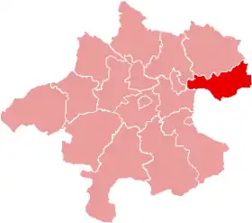 Localisation du district de Perg dans le Land autrichien de Haute-Autriche. | |
| Administration | |
|---|---|
| Pays | |
| Land | |
| Centre administratif | Perg |
| Immatriculation | PE |
| Démographie | |
| Population | 63 955 hab. (15 mai 2001) |
| Densité | 105 hab./km2 |
| Géographie | |
| Coordonnées | 48° 16′ 19″ nord, 14° 40′ 59″ est |
| Superficie | 61 186 ha = 611,86 km2 |
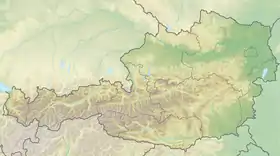
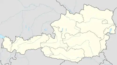
| Localisation | |
Géographie
Lieux administratifs voisins
 |
||
Communes
Le district de Perg est subdivisé en 26 communes :
- Allerheiligen im Mühlkreis
- Arbing
- Bad Kreuzen
- Baumgartenberg
- Dimbach
- Grein
- Katsdorf
- Klam
- Langenstein
- Luftenberg an der Donau
- Mauthausen (ville)
- Mitterkirchen im Machland
- Münzbach
- Naarn im Machlande
- Pabneukirchen
- Perg
- Rechberg
- Ried in der Riedmark
- Saxen
- Schwertberg
- Sankt Georgen am Walde
- Sankt Georgen an der Gusen
- Sankt Nikola an der Donau
- Sankt Thomas am Blasenstein
- Waldhausen im Strudengau
- Windhaag bei Perg
Carte interactive des communes du district de Perg
 Portail de l'Autriche
Cet article est issu de Wikipedia. Le texte est sous licence Creative Commons – Attribution – Partage à l’identique. Des conditions supplémentaires peuvent s’appliquer aux fichiers multimédias.