District de Ghaziabad
Le district de Ghaziabad (en hindi : ग़ाज़ियाबाद ज़िला) est une division administrative de la division de Meerut dans l'État de l'Uttar Pradesh, en Inde.
| District de Ghaziabad ग़ाज़ियाबाद ज़िला | ||
| Administration | ||
|---|---|---|
| Pays | ||
| État | Uttar Pradesh | |
| Chef-lieu | Ghaziabad | |
| Fuseau horaire | IST (UTC+5:30) | |
| Démographie | ||
| Population | 4 681 645 hab. (2011[1]) | |
| Densité | 3 971 hab./km2 | |
| Géographie | ||
| Coordonnées | 28° 40′ 00″ nord, 77° 26′ 00″ est | |
| Superficie | 117 900 ha = 1 179 km2 | |
| Localisation | ||
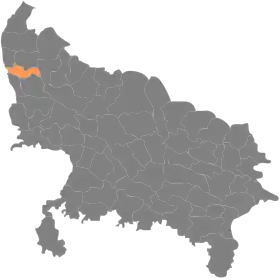
| ||
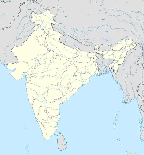
| Géolocalisation sur la carte : Inde
| ||
| Liens | ||
| Site web | http://ghaziabad.nic.in/ | |
Géographie
Le centre administratif du district est Ghaziabad. La superficie du district est de 1 179 km2[1] et la population était en 2011 de 4 681 645 habitants[1].
Le taux d'alphabétisation est de 85 %[2].
Liens externes
Liens internes
Références
- (en) « Districts of Uttar Pradesh », Recensement 2011, Gouvernement de l'Inde (consulté le )
- (en) « District-specific Literates and Literacy Rates, 2001 », Registrar General, India, Ministry of Home Affairs (consulté le )
 Portail de l’Inde
Cet article est issu de Wikipedia. Le texte est sous licence Creative Commons – Attribution – Partage à l’identique. Des conditions supplémentaires peuvent s’appliquer aux fichiers multimédias.