Bangar
Bangar est une municipalité de 3e classe située dans la province de La Union aux Philippines. Selon le recensement de 2007 elle est peuplée de 33 335 habitants.
| Bangar | ||
| ||
| Administration | ||
|---|---|---|
| Pays | ||
| Région | Ilocos | |
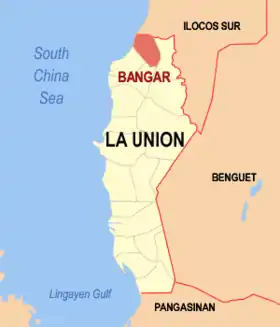
| Province | La Union | |
| Barangays | 33 | |
| Maire | Joy P. Merin | |
| Code postal | 2519 | |
| Démographie | ||
| Population | 33 335 hab. (2007) | |
| Densité | 892 hab./km2 | |
| Géographie | ||
| Coordonnées | 16° 53′ 53″ nord, 120° 25′ 23″ est | |
| Superficie | 3 736 ha = 37,36 km2 | |
| Localisation | ||
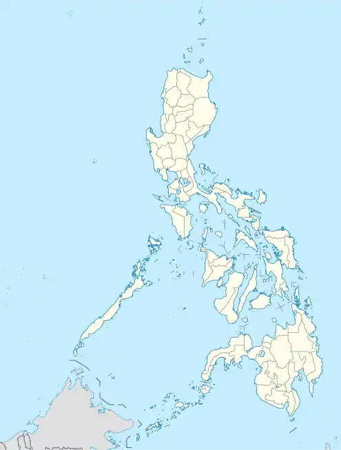
| Géolocalisation sur la carte : Philippines
| ||
Barangays
Bangar est divisée en 33 barangays.
- Alzate
- Barraca
- Caggao
- Quintarong
- Mindoro
- Agdeppa
- Nagsabaran
- Cadapli
- Luzong Norte
- Luzong Sur
- San Cristobal
- Central East No. 1
- Central East No. 2
- Central West No. 1
- Central West No. 2
- Central West No. 3
- General Prim East
- General Prim West
- Bangaoilan East
- Bangaoilan West
- Paratong Norte
- Paratong No. 3
- Paratong No. 4
- Reyna Regente
- Ubbog
- San Blas
- Sinapangan Norte
- Sinapangan Sur
- Rissing
- General Terrero
- Consuegra
- Maria Cristina East
- Maria Cristina West
Démographie
| Année | Habitants |
|---|---|
| 1995 | 28 374 |
| 2000 | 31 491 |
| 2007 | 33 335 |
 Portail de la géographie
  Portail des Philippines
Cet article est issu de Wikipedia. Le texte est sous licence Creative Commons – Attribution – Partage à l’identique. Des conditions supplémentaires peuvent s’appliquer aux fichiers multimédias.