Ashford (borough)
Ashford est un district non-métropolitain et un borough situé dans le comté du Kent, en Angleterre. Son conseil est basé dans la ville de Ashford.
| Borough de Ashford | |
| |
| Administration | |
|---|---|
| Pays | |
| Statut | Borough |
| Région | Angleterre du Sud-Est |
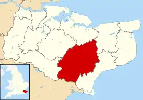
| Comté | Kent |
| Centre administratif | Ashford |
| Leadership | Leader & Cabinet |
| Exécutif | Conservateur |
| MP | Damian Green |
| Code ONS | 29UB |
| Démographie | |
| Population | 115 500 hab. (2010) |
| Densité | 199 hab./km2 |
| Rang | 185e / 326 |
| Ethnicité | 95,0 % Blanc 1,5 % S. Asiatique 1,4 % Noir 1,3 % Race mixte |
| Géographie | |
| Coordonnées | 51° 08′ 47″ nord, 0° 52′ 03″ est |
| Superficie | 58 062 ha = 580,62 km2 |
| Rang | 76e / 326 |
| Liens | |
| Site web | http://www.ashford.gov.uk/ |
Le borough a été formé le .
Liste des 42 paroisses constituant le district
- Aldington
- Appledore
- Bethersden
- Biddenden
- Bilsington
- Bonnington
- Boughton Aluph
- Brabourne
- Brook
- Challock
- Charing
- Chilham
- Crundale
- Eastwell
- Egerton
- Godmersham
- Great Chart with Singleton
- Hastingleigh
- High Halden
- Hothfield
- Kenardington
- Kingsnorth
- Little Chart
- Mersham
- Molash
- Newenden
- Orlestone
- Pluckley
- Rolvenden
- Ruckinge
- Sevington
- Shadoxhurst
- Smarden
- Smeeth
- Stanhope
- Stone cum Ebony
- Tenterden
- Warehorne
- Westwell
- Wittersham
- Woodchurch
- Wye with Hinxhill
Cet article est issu de Wikipedia. Le texte est sous licence Creative Commons – Attribution – Partage à l’identique. Des conditions supplémentaires peuvent s’appliquer aux fichiers multimédias.