Arrondissement de Bayreuth
L’arrondissement de Bayreuth est un arrondissement (Landkreis en allemand) de Bavière, en Allemagne) situé dans le district (Regierungsbezirk en allemand) de Haute-Franconie.
| Arrondissement de Bayreuth Landkreis Bayreuth | |
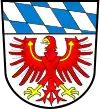 Héraldique |
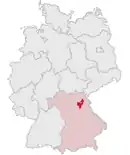 Localisation |
| Administration | |
|---|---|
| Pays | |
| Land | |
| District (Regierungsbezirk) |
Haute-Franconie |
| Chef-lieu | Bayreuth |
| Préfet (Landrat) |
Hermann Hübner |
| Partis au pouvoir | CSU |
| Code arrondissemental (Kreisschlüssel) |
09 4 72 |
| Immatriculation | BT, EBS, ESB, KEM, MÜB, PEG |
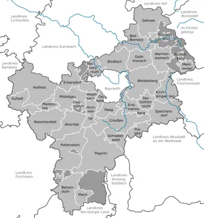
| Communes | 33 |
| Démographie | |
| Population | 103 648 hab. (31 décembre 2021) |
| Densité | 81 hab./km2 |
| Géographie | |
| Superficie | 1 273,09 km2 |
| Localisation | |
.svg.png.webp)
| |
| Liens | |
| Site web | www.landkreis-bayreuth.de |
Son chef-lieu est Bayreuth.
Lieux et monuments
 |
Schloss Aufseß | Aufseß |
| Vue du Château Fantaisie | Eckersdorf | |
| Schloss Freienfels | Hollfeld | |
| Hollfeld | Hollfeld | |
 |
Schloss Wiesentfels | Hollfeld |
 |
Pegnitz | Pegnitz |
| Burg Pottenstein | Pottenstein | |
 |
Teufelshöhle | Pottenstein |
 |
Tüchersfeld | Pottenstein |
| Burg Waischenfeld | Waischenfeld |
Villes, communes et communautés d'administration
(nombre d'habitants en 2006)
|
|
.svg.png.webp) Portail de la Bavière
Portail de la Bavière
Cet article est issu de Wikipedia. Le texte est sous licence Creative Commons – Attribution – Partage à l’identique. Des conditions supplémentaires peuvent s’appliquer aux fichiers multimédias.