Aéroport régional de Lawton-Fort Sill
L'aéroport régional de Lawton-Fort Sill (Code AITA : LAW), est l'aéroport de Lawton en Oklahoma, aux États-Unis.
 Portail de l’aéronautique
  Portail de l’Oklahoma
| Aéroport régional de Lawton-Fort Sill Lawton–Fort Sill Regional Airport | ||||||||||
| Localisation | ||||||||||
|---|---|---|---|---|---|---|---|---|---|---|
| Pays | ||||||||||
| État | Oklahoma | |||||||||
| Ville | Lawton | |||||||||
| Coordonnées | 34° 34′ 04″ nord, 98° 24′ 59″ ouest | |||||||||
| Superficie | 526 ha | |||||||||
| Altitude | 338 m (1 109 ft) | |||||||||
| Informations aéronautiques | ||||||||||
| Code IATA | LAW | |||||||||
| Code OACI | KLAW | |||||||||
| Code FAA | LAW | |||||||||
| Type d'aéroport | civil | |||||||||
| Gestionnaire | Ville de Lawton | |||||||||
| Site web gestionnaire | Consulter | |||||||||
|
||||||||||
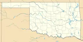
| Géolocalisation sur la carte : Oklahoma
Géolocalisation sur la carte : États-Unis
| ||||||||||
_location_map.svg.png.webp)
Cet article est issu de Wikipedia. Le texte est sous licence Creative Commons – Attribution – Partage à l’identique. Des conditions supplémentaires peuvent s’appliquer aux fichiers multimédias.