Aéroport international d'Atlantic City
L'aéroport international d'Atlantic City (code IATA : ACY • code OACI : KACY) est un aéroport civil-militaire situé 16 km au nord-ouest d'Atlantic City à Egg Harbor Township, dans le New Jersey.
| Aéroport international d'Atlantic City Atlantic City International Airport | |||||||||||||
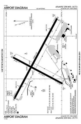 Plan des pistes de l'aéroport | |||||||||||||
| Localisation | |||||||||||||
|---|---|---|---|---|---|---|---|---|---|---|---|---|---|
| Pays | |||||||||||||
| État | New Jersey | ||||||||||||
| Ville | Egg Harbor Township | ||||||||||||
| Coordonnées | 39° 27′ 27″ nord, 74° 34′ 38″ ouest | ||||||||||||
| Altitude | 23 m (75 ft) | ||||||||||||
| Informations aéronautiques | |||||||||||||
| Code IATA | ACY | ||||||||||||
| Code OACI | KACY | ||||||||||||
| Code FAA | ACY | ||||||||||||
| Type d'aéroport | civil-militaire | ||||||||||||
| Gestionnaire | Port Authority of New York and New Jersey & SJTA | ||||||||||||
| Site web gestionnaire | Consulter | ||||||||||||
|
|||||||||||||
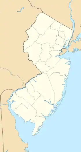
| Géolocalisation sur la carte : New Jersey
Géolocalisation sur la carte : États-Unis
| |||||||||||||
_location_map.svg.png.webp)
Compagnies et destinations
| Compagnies | Destinations |
|---|---|
| Caesars Entertainment Corporation
opéré par | Charter: Select Airports[1] |
| Choice Airways opéré par Swift Air | Charter: Miami, Nashville, Orlando |
| | Fort Lauderdale-Hollywood, Fort Myers, Myrtle Beach, Orlando, Tampa En saison: Atlanta H.-Jackson, Boston Logan, Palm Beach |
Édité le 25/11/2017
Notes et références
- « Atlantic City, NJ », sur Total Rewards Air
 Portail de l’aéronautique
  Portail du New Jersey
Cet article est issu de Wikipedia. Le texte est sous licence Creative Commons – Attribution – Partage à l’identique. Des conditions supplémentaires peuvent s’appliquer aux fichiers multimédias.